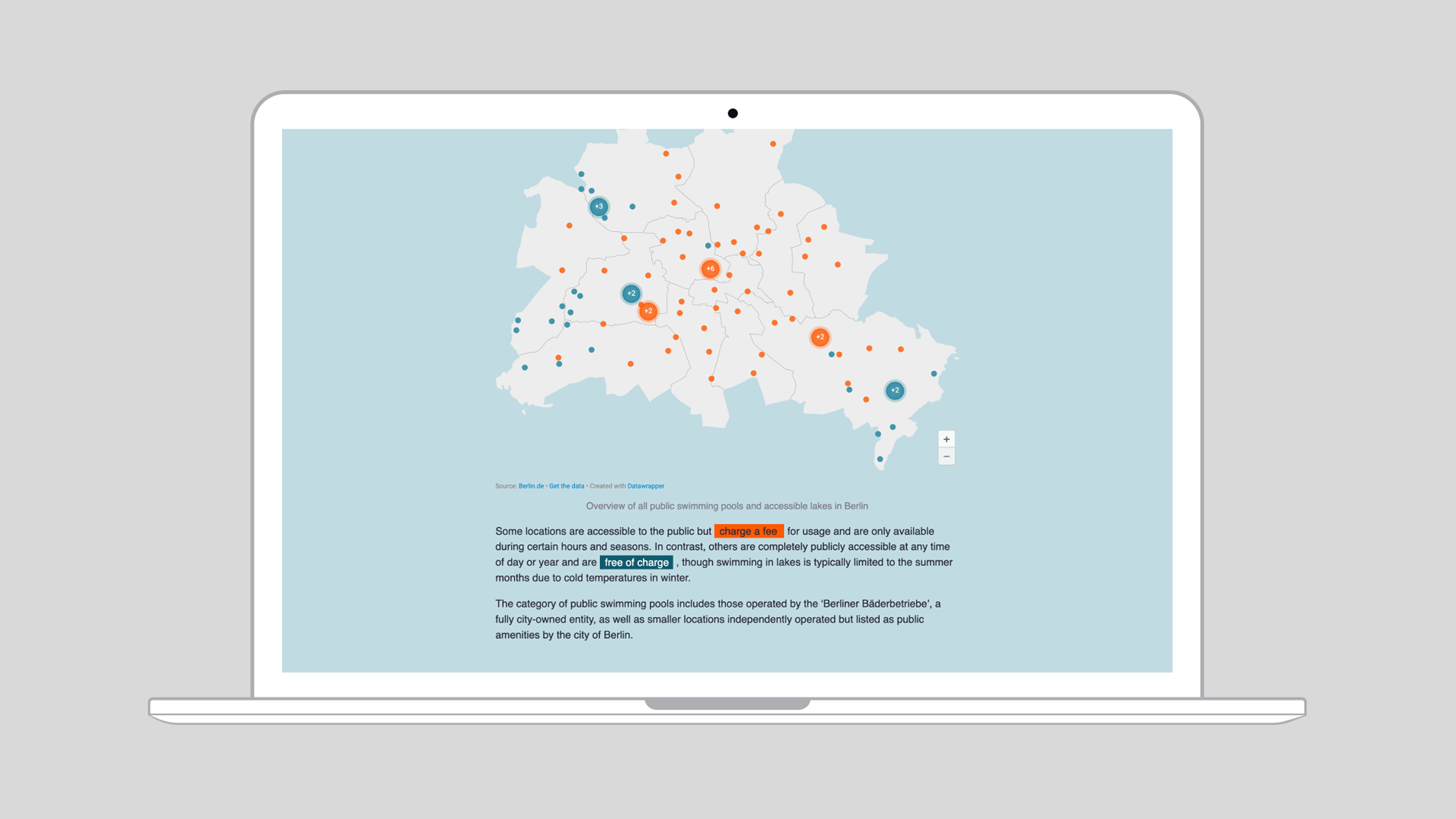
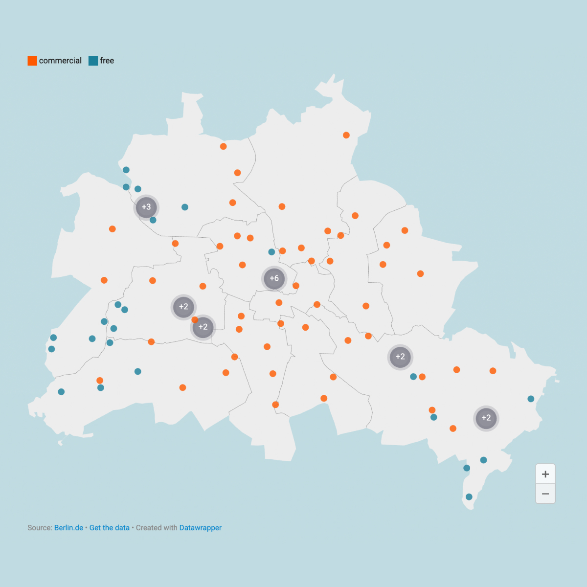
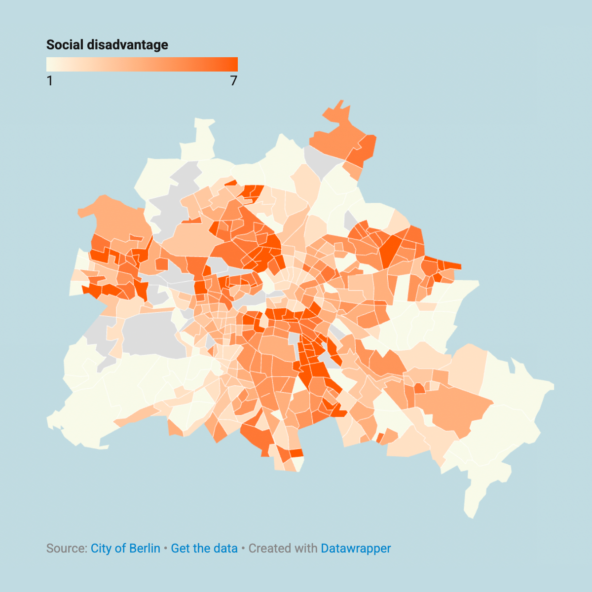
THE DATASET
The foundation of this project is aerial imagery provided by Vertical 52 and Marple. To enrich the dataset, we incorporated climate data from Climate Analytics as well as publicly available data from the Berliner Bäder Betriebe and Geoportal Berlin. By combining these sources, we were able to analyze the distribution of cooling in relation to social factors such as education, employment, and income.
DATA VISUALIZATION
We employed a variety of map-based visualizations to illustrate the spatial distribution of different factors across the city. These visualizations allowed us to identify patterns between environmental variables and socio-economic indicators.
POOL DETECTION
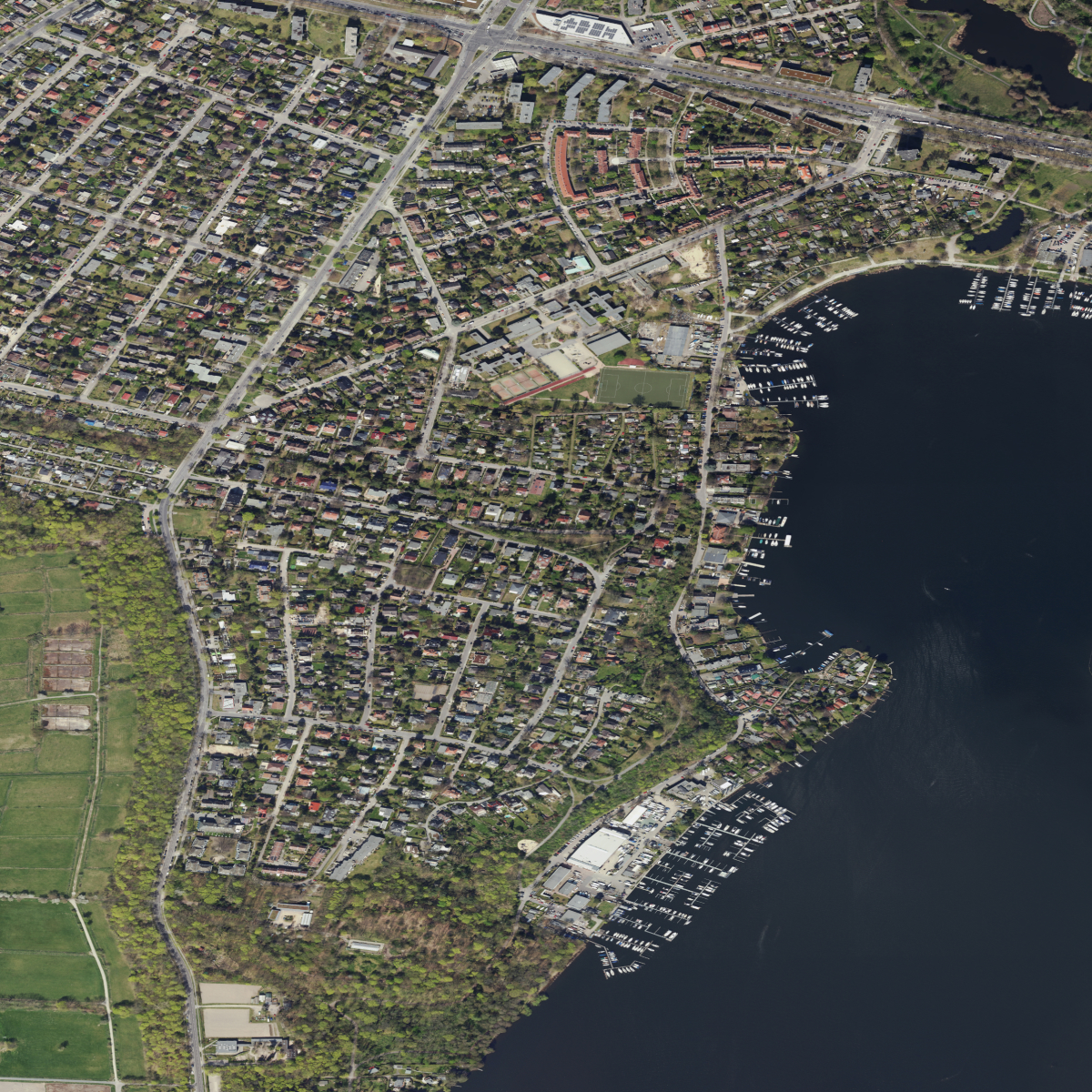
A quantitative assessment of backyard pools in Steglitz-Zehlendorf reveals a high concentration of privately owned cooling amenities within residential properties providing on-site relief during heat events.
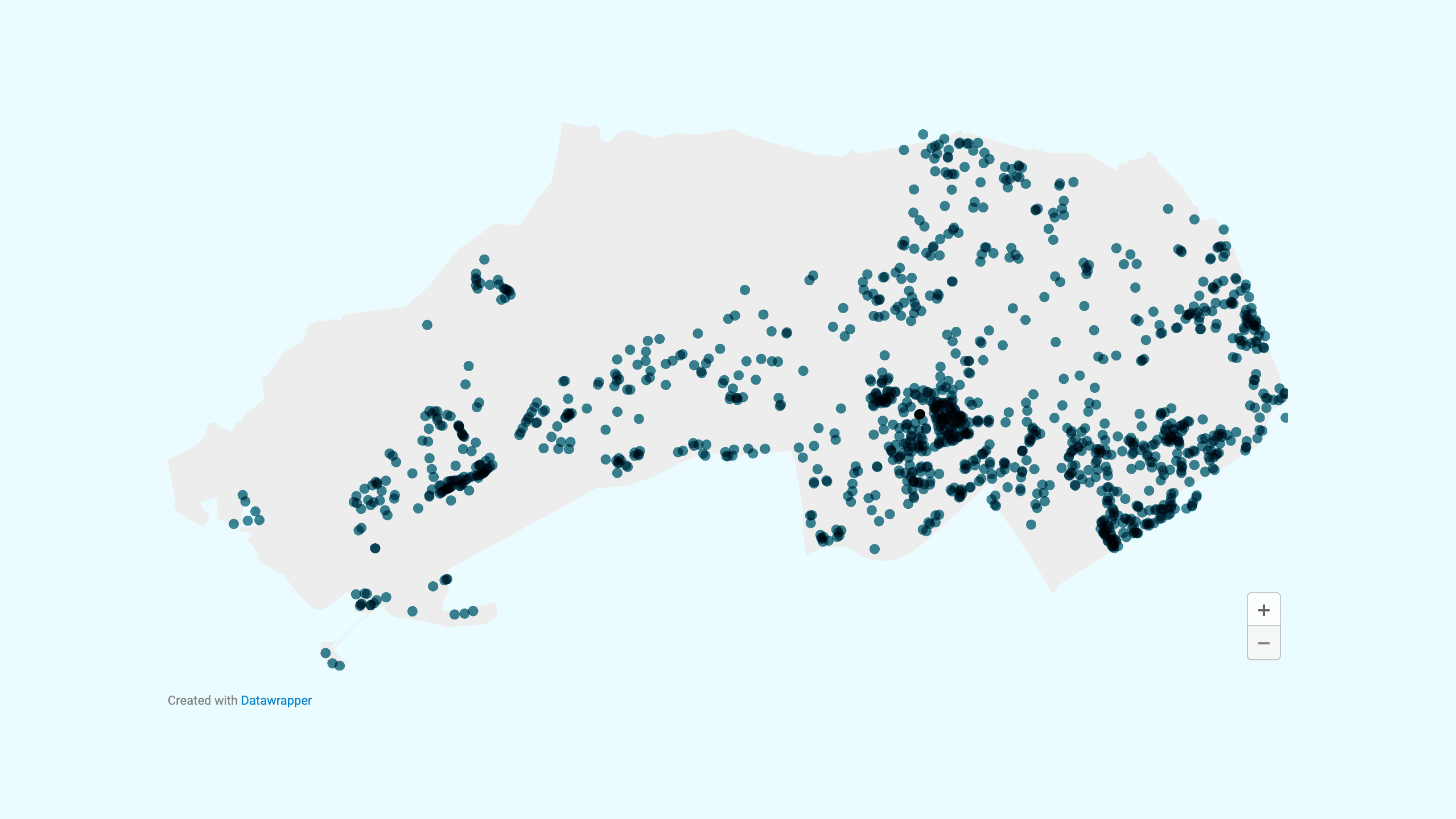
AUTOMATED POOL DETECTION
Amir Hamedpour (Agricultural University of Iceland) supported our project by developing a Python-based model tailored to our satellite imagery, enabling the automated detection of private pools. Amir is a Remote Sensing Engineer and PhD researcher based in Iceland.
After the completion of this project, Der Tagesspiegel picked up on our work and published an article building on the automated analysis of aerial imagery. The article examined the relationship between access to cooling, particularly through amenities such as private swimming pools, and broader patterns of social inequality.
Read the article